Posts by: Mamata Akella
-
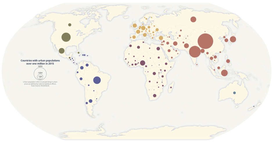
Proportional symbol maps are used to represent point data that are attached to a specific geographic location (like a city) or data aggregated to a point from an area (like a state). The area of each symbol on the map (usually a circle) is scaled according to its value at a given geographic location using either absolute scaling or range-grading. The result is a map where larger symbols indicate higher values and smaller ones, lower values. This type of map is flexible in that you can represent raw data values (total population) or data that are normalized (percentage of population).
In this blog, I’ll walk through the basic principles of proportional symbols and some best practices when designing them. Then, I’ll cover the steps to make a map of 2015 urban population by country using the absolute scaling method.
-
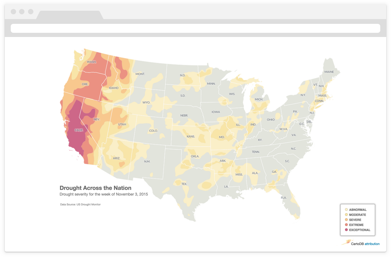
The most common maps built with CartoDB highlight a specific topic or theme of information. Cartographers refer to these as thematic maps. Typically, thematic maps have two components: a basemap and a thematic overlay.
The logical ordering (or visual hierarchy) of elements on thematic maps is especially important. The thematic layer should be highest in the visual hierarchy designed with bold colors to stand out against the more subtly
designed basemap.Building on these ideas, and this previous discussion on map projections in CartoDB, this blog walks through the steps to make a thematic map of current drought conditions in the United States using data from the United States Drought Monitor.
-
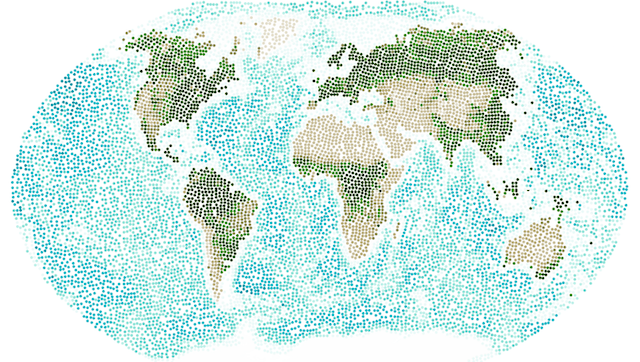
Most maps that we see on the web use the Web Mercator projection. Web Mercator gained its popularity because it provides an efficient way for a two-dimensional flat map to be chopped up into seamless 256x256 pixel map tiles that load quickly into the rectangular shape of your browser.
If you asked a cartographer which map projection you should choose for your map, most of the time the answer would not be Web Mercator. What projection you choose depends on your map’s extent, the type of data you are mapping, and as with all maps, the story you want to tell.
Well, get excited because with a few lines of SQL in CartoDB, you can free your maps from Web Mercator!
