Posts by: Erik Escoffier
-
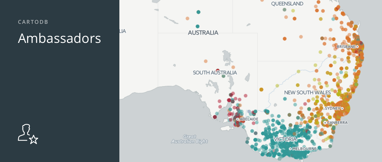
Last year the Ambassadors Program started as an experiment, with select CartoDB users receiving slight upgrades to their accounts. Since then, we have been watching our program grow and find ourselves constantly amazed at the level of talent and passion of our Ambassadors. We like to think that the upgraded Ambassadors accounts (more storage, more layers, sync tables, etc.) have played a part in this. ;)
Because we love what we’ve seen thus far, we are now expanding the Ambassadors Program!
-
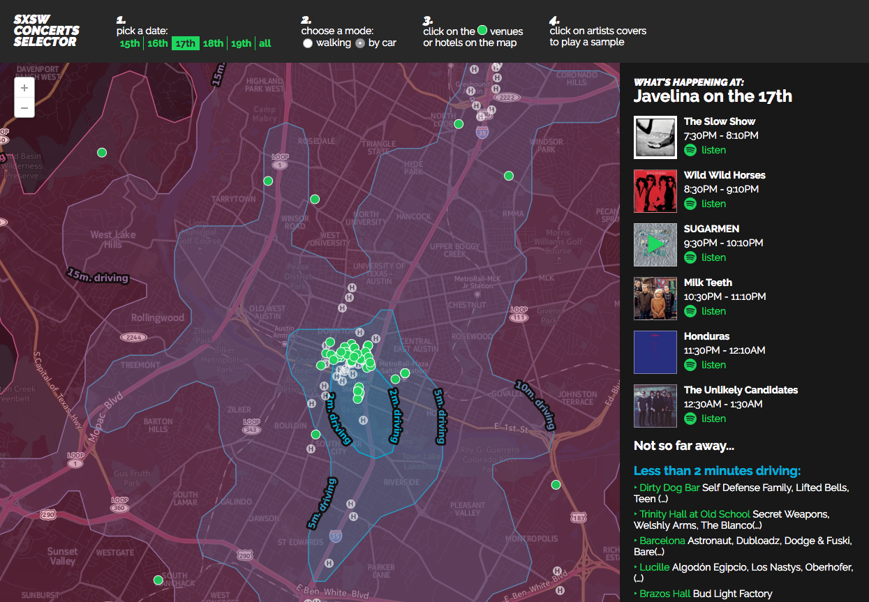
Planning where to strategically go next can be a daunting task. There are numerous factors to consider, like time. At major festivals, like SXSW, planning how long it takes to move from place to place doesn’t have to be so intimidating anymore. Time and Distance Isolines (also called isochrones), a new feature coming to the CartoDB platform, allows you to measure time directly through SQL statements. Time isolines provides insight and analysis on how long it takes pedestrians to move from one hotspot to the next, making tactical business planning a cinch.
-

Are you ready to look at maps in an unorthodox way and expand your cartographic horizons? The “Creative Cartography and Beers on March 11, in Paris, will do just that. And more importantly, seek to establish bridges between mapping and other fields - particularly creative coding and design.
-

Using CartoDB.js and the CartoDB Platform, you get the best of both worlds: powerful GIS technologies with no setup required combined with the complete freedom provided by the HTML5 stack.
It’s so addictive in fact, that at some point you’ll be building a ton of interactive maps without even realizing it. And inevitably, you will end up doing a few repetitive tasks every time: creating boilerplate files, importing JavaScript libraries, setting up a local web server, etc…
