Posts by: Santiago Giraldo Anduaga
-
This is going to sound extreme, but without open source software there would be no internet as we know it. That’s right. Everyday we utilize a technology built on collaborative software that only gets better and more powerful the more open and secure it becomes. Each year a conference celebrating the community and collaborative nature of open source tech happens and we couldn’t be more thrilled to take part.
-
Disaster requires quick action!
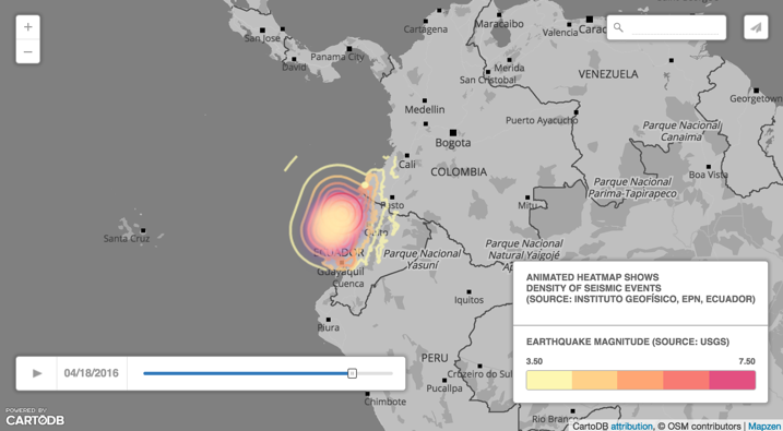
Maps are an incredibly powerful tool for humanitarian crisis response. One of the most compelling phenomena in recent times has emerged from global communi ties committed to solving some of the many challenges that arise from timely humanitarian response. Ground-breaking initiatives such as OpenStreetMap have reframed the ways in which we collectively generate spatial data. Even more importantly, organizations such as the Humanitarian OpenStreetMap Team are taking this culture of mapping to new heights by activating global communities to create previously impossible amounts of data for use in crisis and humanitarian response efforts.
-
Mapping and data analysis are shaping the ways in which news and important stories are shared and understood. A quick browse of our journalism and new media gallery truly places into perspective the emerging practice of data-driven journalism. At the core of data-journalism, we at CartoDB are building a culture of geo-journalism underscored by our wonderful and active journalism community. Simultaneously, we strive to be at the cutting edge of data-journalism innovation with mapping and storytelling tools that take reporting to the next level, robust free accounts for IRE members, and engagement opportunities such as our Ambassador’s Program to help our journalism community get the most from their data. In short, we love data-journalists, we love our communities of storytelling mappers, and we’re celebrating our news-centric love with the Second Annual GeoJourNews Conference! - and you’re invited!
-
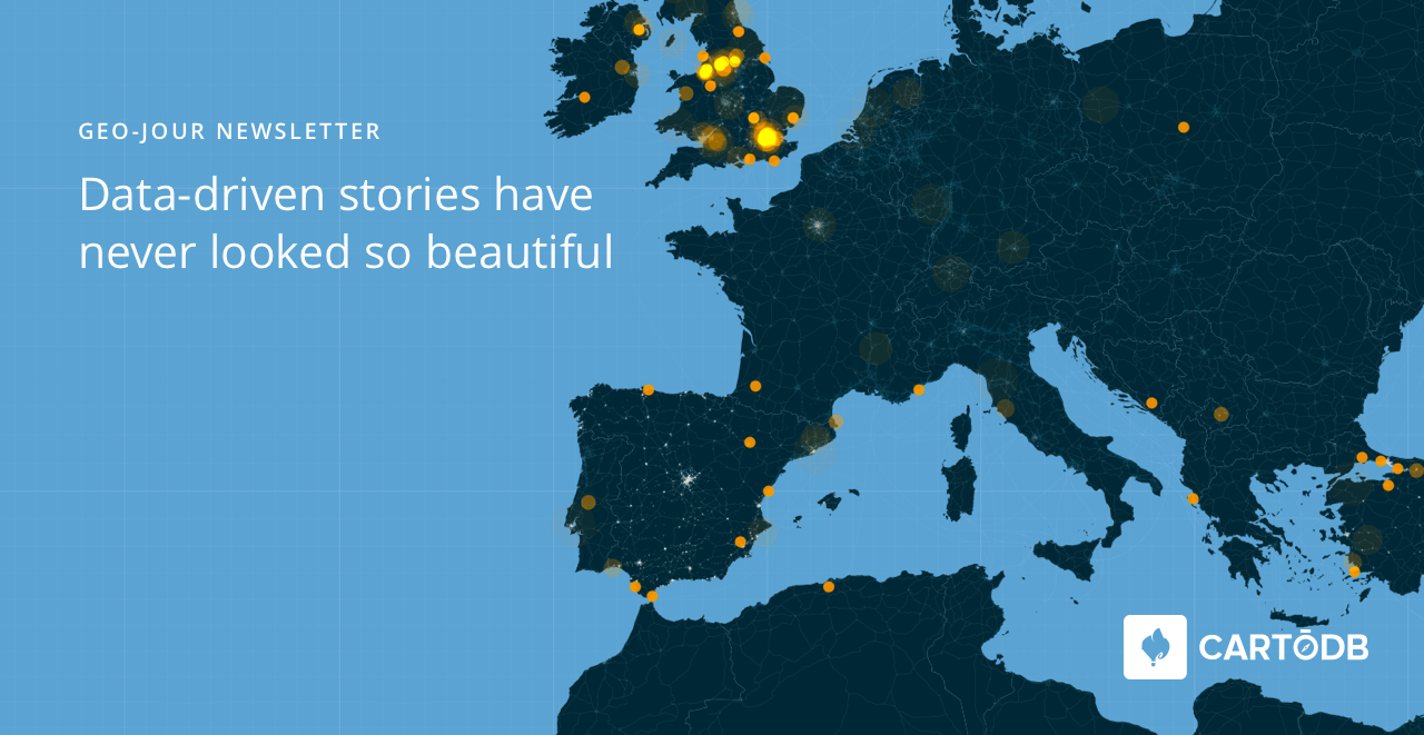
Everyone loves a good story. More than 90 media channels use CartoDB to tell incredible data-driven stories and create industry-leading publications. Because we love our data journalists, we aim to foster a strong community and provide exceptional resources to we can all investigate more deeply and tell
better stories. -
Here at CartoDB we strive to reach new heights of excellence in technology for cities and citizens. Our civic-loving users have always pushed the boundaries of how location intelligence is applied to urban practices, and now we’re giving back in a big way.
-
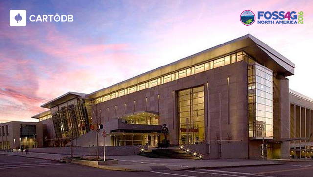
CartoDB is very excited about the upcoming FOSS4G-NA conference!
We’ve given sessions at the conference for the last 2 years and hope 2016 won’t be an exception. Held in Raleigh, North Carolina from May 2-5, this is the premiere conference for free, open source software designed for geospatial in North America. Thousands of participants and hundreds of companies converge to share, demo, and talk about the things we love most.
In order to see us there we need your help!
-
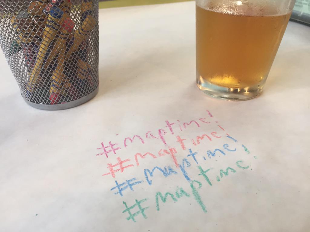
Earlier this year we announced a pizza-love fueled commitment to supporting our worldwide Maptime communities. From our very own Maptime meetup in New York City, we found that the best way to inspire great work and foster community was by coming together around the workspace table and whirring laptops to enjoy delicious pizza and talk maps. We wanted to make this experience a worry-free staple in everyone’s Maptime meetup. This is why we committed to donating every pizza, for every Maptime, everywhere for a whole year, and we’re only half way done!
-

Here at CartoDB we are always looking for new ways to enable our educational communities. From our commitment to Education and Research in the Classroom to our popular Educator’s Nights and workshops at universities, we’re working hard to spark new ideas in geospatial visualization and analysis across all professional fields.
-
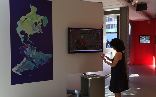
About a month ago, we announced Insight, our first ever data and design competition in conjunction with Measure, a New York City exhibit by Storefront for Art and Architecture. With the competition close at the end of last month, we wanted to thank all of the teams who submitted projects and emphasize that we were truly blown away by the quality of maps and insight shared by our stellar community. With over 60 incredible submissions, our team spent days deeply exploring each project and deliberating in selecting the top 5 most outstanding projects to enter into our finalists round. CartoDB is proud to announce our Insight: A data and design competition finalists for 2015!
-
CartoDB prides itself on helping empower organizations and people to achieve great things and make the world a better place. Our ever-growing climate and non-profit grants have provided innovative organizations with tools and infrastructure to have meaningful impact from the neighborhood all the way up to the world.
-
There have been many exciting happenings this month at CartoDB. From growing our partnership with Code for America, to our upcoming CartoCamp at NYU it’s been a busy week for our community! Earlier this month we also announced Insight. A Data and Design Competition in conjunction with Measure, a Storefront for Art and Architecture exhibit in New York City. We have had a lot of insightful projects already submitted, and with the August 31st deadline just short of two weeks away, we want to inspire our world of map makers to submit some great maps and creative projects!
-
As our first ever data and design competition ramps up, we at CartoDB and Storefront for Art and Architecture are working hard to make both the competition and the Measure exhibit a big success with our all-star panel of competition judges!
In case you’ve been under a rock the past week, CartoDB in conjunction with Measure, a Storefront for Art and Architecture exhibit in New York City announced Insight: A Data and Design Competition. This open call for submissions brings together data visualization and the built environment in contemporary culture, with the goal of inspiring beautiful, creative, and complex works using CartoDB.
-
We love our community of mappers, designers, and data-afficionados. Which is why CartoDB is proud to announce: Insight. A Data and Design Competition in conjunction with Measure, a Storefront for Art and Architecture exhibit in New York City!
-

CartoDB has always been a big advocate of civic technology. From our partnerships with organizations such as Code for America and rapidly growing grant programs for startups, climate action, and non-profits, we’re always looking for ways to help civic tech organizations and companies excel at what they do best.
Recently, we had the pleasure of collaborating with PlaceSpeak, a Vancouver-based company that has taken cities and civic participation to new heights across the world! With our love for civic technology, beautiful and insightful mapping, and community collaboration, it was only a matter of time before our paths crossed and civic co-creation with cutting edge technology was able to blossom.
-
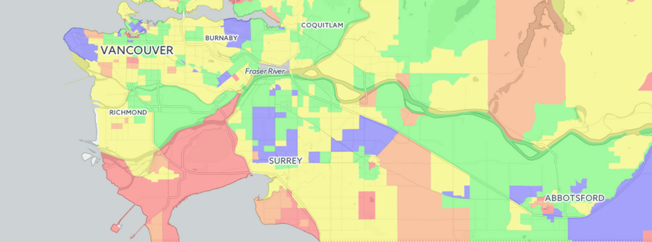
Last week CartoDB had the pleasure of speaking with entrepreneur and real estate map guru Dan (Vadim) Marusin. He is the founder of EstateBlock, a Vancouver Canada based real estate search engine startup powered by CartoDB! Dan discovered CartoDB out of a need to provide easily accessible, high quality, data-secure interactive maps to provide his clients something that had not been done before in Vancouver: provide in-depth and easily accessible insight to home owners and buyers. Below, Dan shares his story.
-
CartoDB has always been committed to empowering communities, people, and organizations that seek to use mapping and data for civic prosperity and growth. From our long-running climate and non profit grants, to sponsoring mapping meetups across the country, we are always looking for new ways to support efforts that re-think how data, mapping, and programming impact civic engagement.
-

In the high-speed world of data journalism it’s always important to stay on top of the latest story. Being able to quickly and beautifully visualize information in creative ways is essential! That’s why our team here at CartoDB is committed to not only providing the go-to world-class journalism mapping tool, but we’re also cultivating a journalism mapping community with efforts such as training sessions, journalism conferences and events, and now, our bi-weekly CartoDB JournoNewsletter!
-
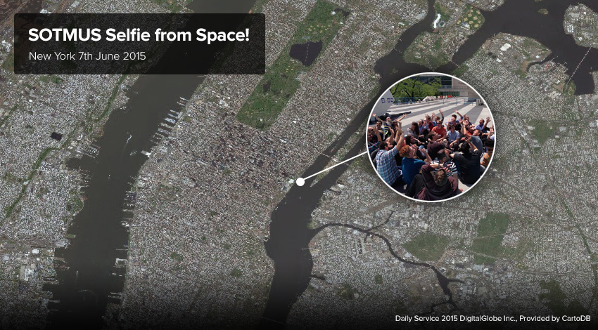
As you may know, last week the United Nations Headquarters in New York City hosted the monumental State of The Map US Conference, and for a few days, the CartoDB team and map lovers from around the world got together for some incredible events and happenings across the city! You may have also noticed that our team here at CartoDB in partnership with DigitalGlobe took this opportunity to take the first ever high resolution satellite selfie from space!
-
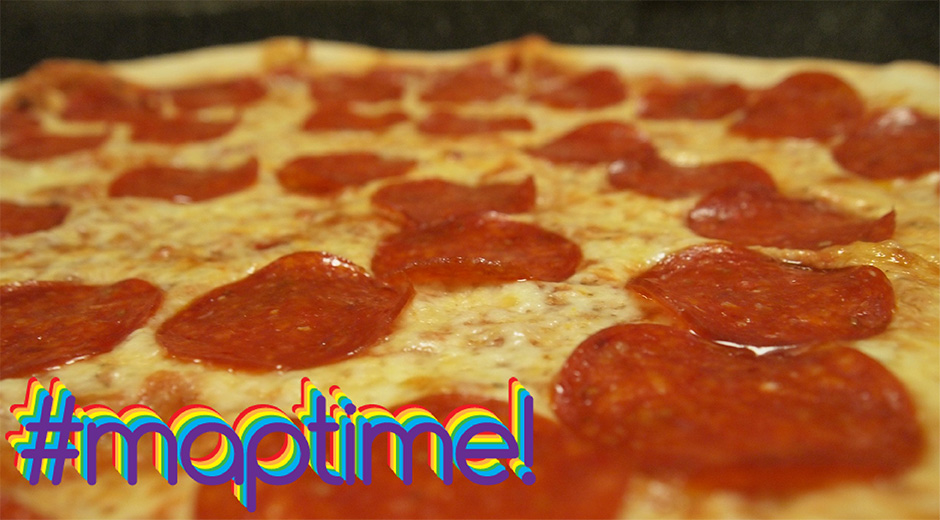
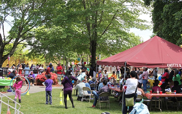
Supporting our mapping communities around the world is a big slice of what CartoDB is all about. We feel that it’s our fellow mappers and GIS communities that have helped shape what CartoDB is today. This is why a few months back CartoDB had the pleasure of buying pizza for a world of mappers for our March of Maptime! The pizza was a hit, and we had a blast, so we asked ourselves: “Why stop there?”.
-
At CartoDB we love our mapping communities. With Maptime being one of our favorite gatherings - and a catalyzer of mapping culture not only in CartoDB’s home of New York City, but across the world - We felt it was time to give a big pizza slice shaped thank you to all the map-building, pizza-loving folks that have elevated Maptime as a staple in cartographic culture.
-
Making maps can be a challenge. Whether you’re just getting started with the CartoDB Editor or you’re a seasoned geo-spatial developer using the CartoDB Platform, The tools that CartoDB offers allows for incredible versatility in how data is visualized, analyzed and made interactive. Just take a look at some of the awesome use-cases in our gallery!
-

With this third installment of our Developer Interview series, we welcome Fedor Baart to join the discussion about how scientists and developers using CartoDB for research and geospatial science!
-
As many know, CartoDB’s commitment to elevating efforts in conservation, climate change, and the environment has shaped our practice and given way to many exciting mapping projects such as the creative and impressive Carbon Calculator and the Global Forest Watch Map that allows users to monitor deforestation in real time.