-

As summer turns to fall, BBQ and lemonade gives way to packed lunches and cafeteria delights. But back-to-school stays cool with CartoDB’s Education Whitepaper. Ready to elevate your classroom lectures and group projects, CartoDB’s Education Whitepaper provides solutions for map-based data visualization, analysis, and storytelling - with no coding skills required.
-
There have been many exciting happenings this month at CartoDB. From growing our partnership with Code for America, to our upcoming CartoCamp at NYU it’s been a busy week for our community! Earlier this month we also announced Insight. A Data and Design Competition in conjunction with Measure, a Storefront for Art and Architecture exhibit in New York City. We have had a lot of insightful projects already submitted, and with the August 31st deadline just short of two weeks away, we want to inspire our world of map makers to submit some great maps and creative projects!
-

Once a year the worlds of tech and music converge in a celebration of all things cool, hip, and innovative. South by Southwest is one of the most important tech events in the United States. Last year, this popular festival received more than 3,500 entries - making panel selection a really competitive process.
It is with great pleasure that CartoDB announces our three submitted panels for SXSW Interactive PanelPicker!
-

The migration from GME to CartoDB is incredibly easy. Organizations ready to make the switch can maintain the same great platform and elements that make cartography and data visualization great.
-
With summer starting to wrap up in the Northern Hemisphere, so are trips to the beach, the mountains, or anywhere in between. What better time than now to highlight all the memories made with your GPS mobile device?
-
As our first ever data and design competition ramps up, we at CartoDB and Storefront for Art and Architecture are working hard to make both the competition and the Measure exhibit a big success with our all-star panel of competition judges!
In case you’ve been under a rock the past week, CartoDB in conjunction with Measure, a Storefront for Art and Architecture exhibit in New York City announced Insight: A Data and Design Competition. This open call for submissions brings together data visualization and the built environment in contemporary culture, with the goal of inspiring beautiful, creative, and complex works using CartoDB.
-

We’re hosting a workshop in Chicago, IL, this week, and you’re invited! Join us for some geo-fun as we take on the Chi-town civic tech scene.
-
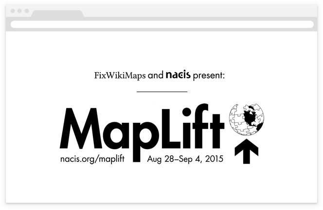
As mappers, you might be familiar with a few theories of cosmology related to how our earth supports itself, the less scientific of them being the most fascinating. In Ancient Greece and Rome, Atlas was the titan who lifted the earth and sky. In A Brief History of Time, the opening anecdote suggests that the earth is flat and supported on the back of a turtle, or a chain of “turtles all the way down”.
While the globes of myth were supported on the shoulders (and shells) of a few, today’s cartography is the crowdsourced result of a world of contributors. We like to think that contemporary mapmakers are building the modern atlas, and resources like Wikipedia support the modern gazeteer. At MapLift you can contribute to both! What’s more, we’ll give you CartoDB support to do so! Read on to learn more about how we’re partnering with NACIS to build a better open gazeteer for the world.
-
At the invitation of Eva Adler and Norman Shamas, I had the pleasure of giving a workshop on CartoDB’s real-time mapping capabilities for the TechChange class Mapping for Social Good. Eva Adler’s course covers an impressive array of material on web mapping related to global development work.
-
We love our community of mappers, designers, and data-afficionados. Which is why CartoDB is proud to announce: Insight. A Data and Design Competition in conjunction with Measure, a Storefront for Art and Architecture exhibit in New York City!


