-
A few months ago we announced our brand new free basemaps—Positron and Dark Matter—built with OpenStreetMap data and designed with the help of our friends at Stamen; your data will absolutely pop when using them.
-
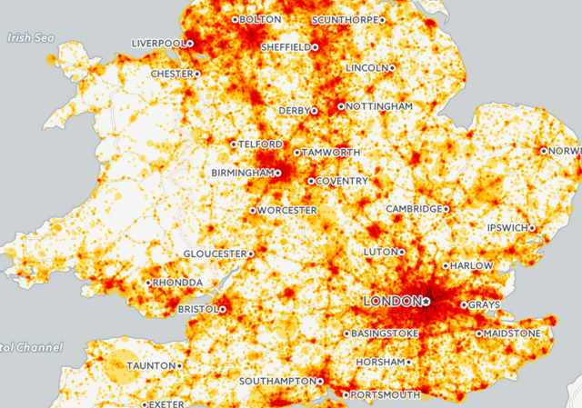
As humans, our sense of smell, or olfaction, often triggers the recollection of memorable experiences and the reflexive tuning of our taste buds. How we rectify these triggers with our physical experience informs our response to navigation and often our reaction/attraction to others, areas, and items in our world. In this, the aromatic qualities of our urban landscape absorb a perfume accessory to its inhabitants but often heavily informed by their presence, and ever-important to our experience of geographic space.
A few projects have tackled the geospatial architecture of city scents, and most recently, so has our featured guest blogger. Read on to learn how he built SmellScapes using CartoDB!
-
Recently, I was working with an utility company that wanted to use CartoDB as a web mapping platform replacement for the way they currently generate maps of their physical infrastructure: AutoCAD.
-
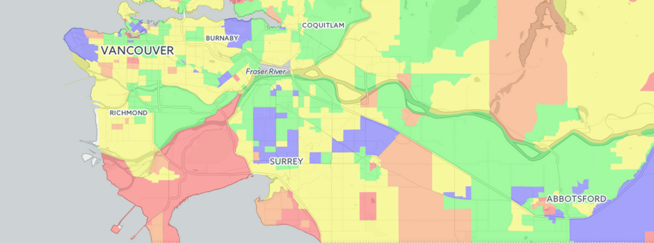
Last week CartoDB had the pleasure of speaking with entrepreneur and real estate map guru Dan (Vadim) Marusin. He is the founder of EstateBlock, a Vancouver Canada based real estate search engine startup powered by CartoDB! Dan discovered CartoDB out of a need to provide easily accessible, high quality, data-secure interactive maps to provide his clients something that had not been done before in Vancouver: provide in-depth and easily accessible insight to home owners and buyers. Below, Dan shares his story.
-
Explore all the varying possibilities of London business infrastructure with GROW.LONDON, a geographic visualization tool developed to help businesses and investors identify key areas to invest in, grow, and expand in the London metropolitan area. Using the power of CartoDB, GROW.LONDON is mapping toward a global urban future where knowledge of diversifying business analytics helps make better decisions and better cities. By visualizing different sets of data using CartoDB’s platform, it’s possible to make accurate business predictions that will likely frame the landscape and competition of an ever enterprising city.
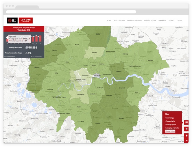
"The GROW.LONDON project had a set of complex requirements. One of them was the capability to easily update some of the maps. In a typical scenario, we would have had to create a complex and expensive back-end interface; with CartoDB, however, this possibility comes right out of the box and allows us to readily manipulate data on hover and on click. Our client can use the built-in user interface to update and test the data for all the maps in the project." Manuel Timita, Founder of Illustreets.
-
When we talk about maps in our present, we often forget the intrepid legacy of mapmaking in our past. Some subtle reminders of the struggles behind our geographic sensitivities still hold strong; names like “Mercator” and “Coronelli” echo in our projections and account plans at CartoDB, but rarely do contemporary cartographers think about our own maps as being particularly pioneering, or the product of an adventure.
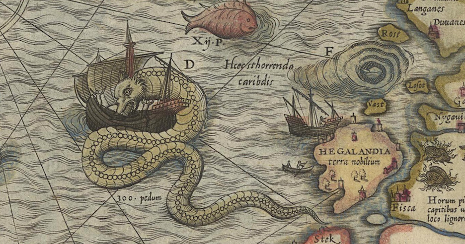
This week’s featured mapper still holds to the epicness of exploratory maps. Anthony Goddard runs a small project called ZeroSixZero, which builds custom realtime tracking maps for expeditions and adventurers. Read on to learn how he makes maps that track the trails of post-modern pioneers!
-

CartoDB has always been committed to empowering communities, people, and organizations that seek to use mapping and data for civic prosperity and growth. From our long-running climate and non profit grants, to sponsoring mapping meetups across the country, we are always looking for new ways to support efforts that re-think how data, mapping, and programming impact civic engagement.
-
What a victorious last week’s Friday! The Supreme Court of the United States announced today, June 26, 2015, the legalization in ALL states of same-sex marriage. The timing couldn’t have been more perfect. Last week was the last of the Supreme Court’s term and the beginning of Pride Week in two major U.S. cities: San Francisco and New York City.
-

Brad is the newest member of our business development team. He will be working with our partners to ensure that we’re helping them succeed in building fantastic location analysis tools with CartoDB. Most recently, he managed partner relationships at Google.
-

Roger worked at Accela as the Director of Solution Sales Consultants for North America. Before that he worked as a Public Sector Employee. Creating statewide GIS programs to inform and improve critical land use and environmental planning decisions. Roger earned his Bachelor’s Degree in Environmental Sciences, followed by a Master’s Degree in Urban and Regional Planning. He was an adjunct professor at Rutgers University teaching courses in GIS and public policy.


