-
With the news that Google is shuttering its Google Maps Engine product (GME) in less than a year, many new clients have come to CartoDB in search of a “new home” for their geospatial needs. For organizations still looking at migrating from GME to CartoDB, our partners over at CloudSherpas have covered in detail both “why” CartoDB is a great choice and the technical “how” of the transition (hint: it’s easy!). But any large organizational software migration can be challenging to wrap one’s head around, which is why we wanted to go a step further and compare, 1-on-1, some common workflows and uses of GME (right from the GME documentation) and how one would accomplish those same tasks within CartoDB. Read on to discover just how easy it can be to move to CartoDB!
-
With the deprecation of Google Earth API and Earth Enterprise we receive a lot of questions about how CartoDB can be a viable alternative to provide a 3D environment for geographical information. On this post we share with you a new iteration after our first post. Publishing 3D geodata with CartoDB and consuming it with Cesium makes a perfect match with all the benefits of a modern open web architecture based on reliable APIs and decoupled components.
-

In the high-speed world of data journalism it’s always important to stay on top of the latest story. Being able to quickly and beautifully visualize information in creative ways is essential! That’s why our team here at CartoDB is committed to not only providing the go-to world-class journalism mapping tool, but we’re also cultivating a journalism mapping community with efforts such as training sessions, journalism conferences and events, and now, our bi-weekly CartoDB JournoNewsletter!
-
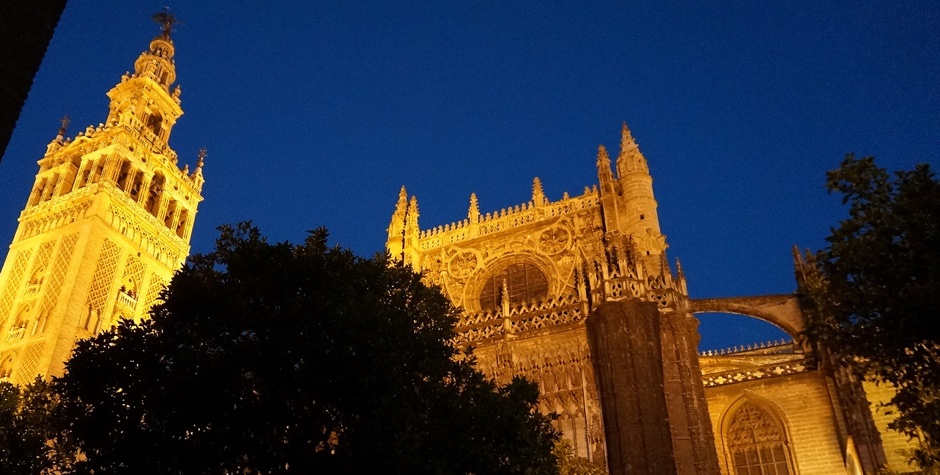
This weekend almost 80 people gathered in a nice country house located in the middle of the park of El Alamillo in Seville at Geocamp ES to discuss open data, open source and geospatial information. Geocamp ES 2015 is the third edition of a conference series following the lead of Geocamp in Portugal. Past editions where organized by Geoinquietos Galicia in Vigo and A Coruña and this year Geoinquietos Seville took the flag to organize this unconference. The format of Geocamp ES is a one day event with some of the talks programmed and the rest of them proposed the very same day. The schedule is finally defined at the beginning of the conference with a relaxed timing to give time for discussion while others talks are shorter and focused to the topic.
-
CartoDB is built on top of PostGIS, the powerful add-on that turns PostgreSQL into a spatial database. Many popular Geoprocessing functions in GIS software can be done with PostGIS queries, and this blog series will provide a one-for-one replication of the functions in QGIS’ Vector>Geoprocessing Tools menu.
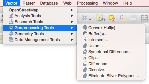
In QGIS, the Vector menu has all sorts of goodies, but we’ll focus on the Geoprocessing Tools submenu, which has Convex Hulls, Buffers, Intersects, Unions, Dissolves, and more. If you’re making maps, these are important tools for the data-munging process, and with a little SQL and PostGIS you can do them right here in CartoDB! We’ll start with two: Convex Hull and Buffer.
-
"When people on airplanes ask me what I do, I used to say I was a physicist, which ended the discussion. I once said I was a cosmologist, but they started asking me about makeup, and the title 'astronomer' gets confused with astrologer. Now I say I make maps."
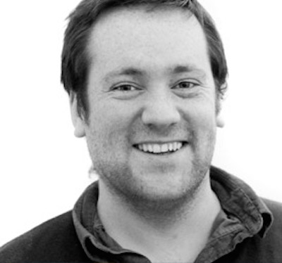
If you’re a physics buff then you might recognize the above quote as one from Margaret Geller, astrophysicist and author of Einstein-esque zingers. We’re physics buffs at CartoDB. Half of our Community Team earned its formal education in a field that studies the physical properties and phenomena of our world. This makes sense, since folks who build tools to map humanity understandably stem from a fascination with flux in the physical topography of our universe. With the addition of Stuart Lynn, our team of hackers grows to accommodate a pretty brilliant and inquisitive scientist with a background in planet tracking, climate mapping, and studying ‘spooky matter’ of galactic proportions.
Read on to get to know our newest Map Scientist at CartoDB!
-
Early June was a grand month for conferences in the civic tech and mapping scene. Reviewing the online documentation for the Personal Democracy Forum, State of the Map, and the concurrent OKFN meetups reveals a healthy two weeks of activity on the USA-EST front. With so much hyper-local happening, we at CartoDB decided to stay local as a team, and outsource our distant conference attendance to a deserving academic. Two weeks ago, we tweeted asking for the “best mapping visualization in exchange for a free ticket to Eyeo,” and while there were several worthy submissions, one was superior to the rest.
-
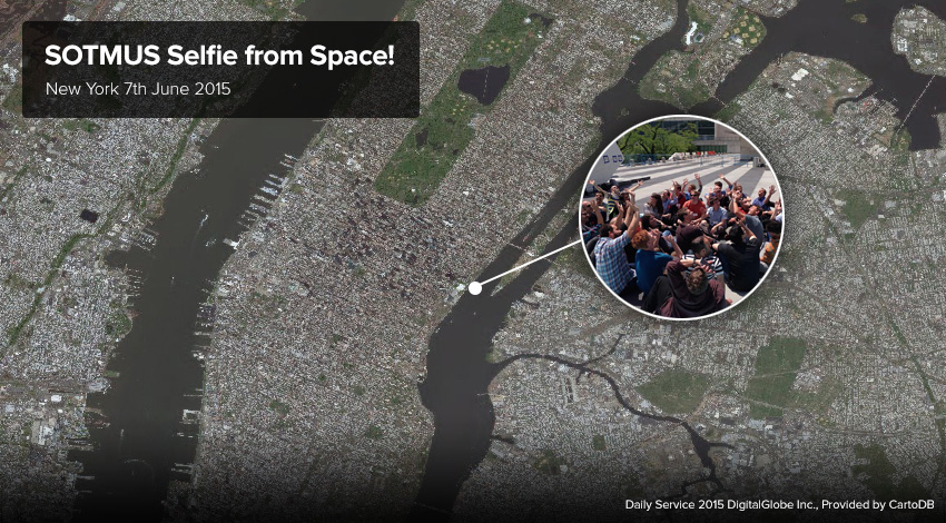
As you may know, last week the United Nations Headquarters in New York City hosted the monumental State of The Map US Conference, and for a few days, the CartoDB team and map lovers from around the world got together for some incredible events and happenings across the city! You may have also noticed that our team here at CartoDB in partnership with DigitalGlobe took this opportunity to take the first ever high resolution satellite selfie from space!
-
In the second addition of our series on clever mapping with GDELT data (see this post from last week), we wanted to take on some more advanced mapping techniques. Again, we welcome Kalev H. Leetaru of the GDELT Project to explain how using geospatial information about journalism can build a better understanding of media in our world! Read on for more!
-
Just over the East River, from our Brooklyn office, State of the Map US 2015 kicked off at the United Nations headquarters with a weekend packed full of mapping oriented talks, activities, and events. We at CartoDB were excited to take part and engage with a community filled with innovative thinkers - bringing the world up-to-date at the biggest Open Street Map conference. All of the energy of the mapping world converged in one space to make a great and invigorating affair.


