-

From March 2-5, we will be at the Mobile World Congress in Barcelona showcasing our latest developments in geospatial platforms and other mapping technologies. The CartoDB team will be ready to engage in and demonstrate the use and efficacy of location-based services and maps—a considerable part of the mobile experience.
Apart from learning about CartoDB, don’t miss ‘The Next Generation Mapping platform will be Open Source,’ a panel we are hosting with some of the most influential people in the mapping industry. The panel will be on March 4 at 3:30 p.m. in the presentation area of the Spanish Pavilion (Congress Square CS60).
-
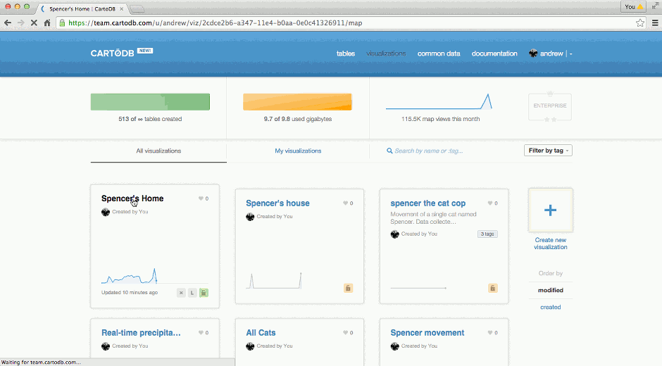
If you missed our Valentine’s Day blog post you may have also missed that CartoDB now has the ability to generate static images of dynamic maps from your accounts. Now we’ve added the capability directly to your CartoDB Editor. From any visualization, quickly generate static images to embed in your presentations, share over email, or anything else your heart’s desire.
-

With this third installment of our Developer Interview series, we welcome Fedor Baart to join the discussion about how scientists and developers using CartoDB for research and geospatial science!
-
This past week, the NYTimes posted an extended piece on mapping county-level lynching data, a topic of interest to some of our academic users and in particularly, Michael Weaver. Michael is a Ph.D candidate in Political Science at Yale University, where he investigates the causes and consequences of ethnic violence.
His dissertation is on how the changing nature of publicity helped turn Americans against lynching, and this week, his Torque map is our Map of the Week. Read on to learn about his research in his own words.
-
This week marks a winter slurry of holiday occasions, including Lincoln’s Birthday (Wednesday), World Radio Day/Friday the 13th (Friday), Valentines Day (Saturday!), and Halfprice-Chocolate Day (aka, Sunday)! In the spirit of the latter (two), we celebrated this week with our community at Monday’s Geo-NYC Meetup, prefiguratively themed “Love Stinks.” Our plan was simple/typical: make some cool maps to give people hope this holiday season. Read on to learn how we did it.
-
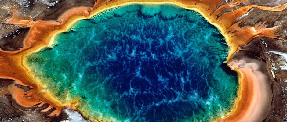
FME, a product of CartoDB partner Safe Software, is the most flexible glue around for connecting two applications via their spatial data. And FME now supports CartoDB. Supporting more than 325 file formats, FME is a real workhorse. In fact, FME is so versatile, we think it could be a handy way to prep for the Yellowstone Supervolcano. You know, just in case.
-
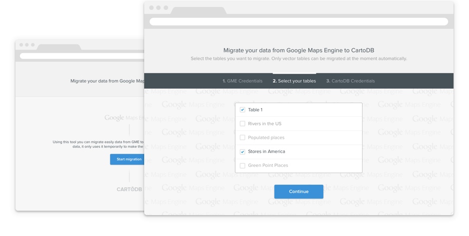
Recently, we announced the availability of CartoDB on Google Cloud Platform. Our intention is to provide a great resource for those projects making use of the Google Maps API and help former Google Maps Engine customers continue their projects into the future.
-

We’re excited to introduce our latest addition to our NYC team, Brittany Micek! Brittany is going to be working in the Community team as a Content Writer.


