-
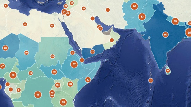
For folks working in global development – whether in micro-finance or environmental protection or food security – one common challenge is collecting data from a huge range of far-flung projects. New technology tools are helping, though, and bringing loads of useful NGO data online.
-
Making maps can be a challenge. Whether you’re just getting started with the CartoDB Editor or you’re a seasoned geo-spatial developer using the CartoDB Platform, The tools that CartoDB offers allows for incredible versatility in how data is visualized, analyzed and made interactive. Just take a look at some of the awesome use-cases in our gallery!
-
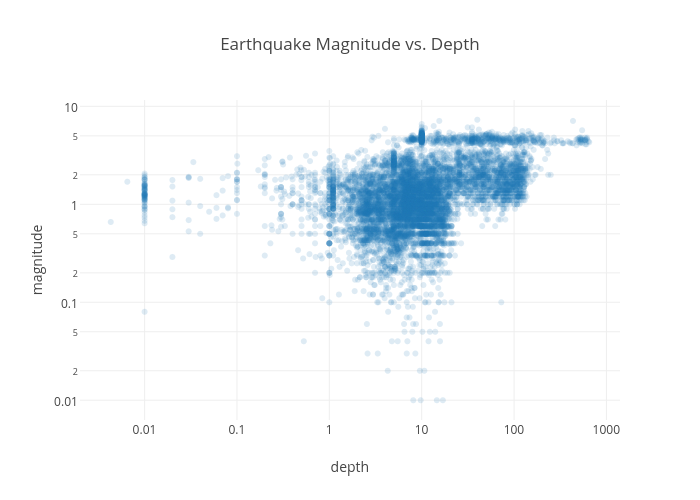
CartoDB, Plotly, and IPython notebooks work beautifully together. The plot above was made on Plotly from data imported into an IPython notebook using the CartoDB SQL API.
-
When Sade sang in ‘Smooth Operator’ – “Coast to coast, LA to Chicago” – she obviously hadn’t consulted a map.
For starters, L.A. - Los Angeles (not to be confused by the abbreviation of Louisiana, a southern U.S. state) is on the coast but what about Chicago? Only if you count the coast of Lake Michigan.
-
The Geobeers will be taking the Mobile World Congress by storm on Wednesday, March 4th at 8 PM! A few mapping companies will be at Mobile World Congress and we thought it would be a great idea to get together to talk and have some beers.
-
World Radio Day was celebrated around the world last week in acknowledgment of the impact and importance of radio. We’re late to the party, but couldn’t think of a better way to celebrate the importance of radio than with a torque heatmap of Low Power FM radio stations going on the air - tracking the expansion of LPFM service from 2000 - March 2011 with data provided by the FCC.
In what ways is Low Power FM radio, otherwise known as independent or community radio, so important?